Remote sensing technologies provide people access to a variety of information from the Earth’s surface that is not available to the human eye. With their help, it’s possible to track changes in global weather conditions, temperatures, glaciers, ocean streams, etc. With up-to-date satellite images at your disposal, you can follow the processes on the planet or compare them with historical pictures and discover crucial patterns and factors that led to particular events.
With the advancement of technology, anyone with internet access can now view space pictures of our planet. You just need to know where to look. Various portals available for amateur and scientific research purposes collect these space images.
The use of sources of free satellite imagery provides many benefits for various sectors. It provides valuable information that can help assess risks, improve decision-making, and contribute to solving global issues.
EOS Data Analytics, a provider of reliable AI-based satellite imagery analytics, has created a digital solution for quickly searching, visualizing, and processing data for various types of businesses and purposes, EOSDA LandViewer. The tool provides access to images from multiple sources, such as Sentinel and Landsat satellites.
Users can easily search for the imagery they need by highlighting the area of interest and applying various platform features to process the pictures and extract valuable data. Once the images are processed, they can be uploaded anytime, saving users time and space on their devices.
Supply Chain Optimization
Over time, various industries have required more data to improve their operations. Data is crucial for accurate delivery forecasting, tracking, and risk monitoring in supply chain management. Satellite imagery data provides a range of crucial benefits for the sector because it can help to reveal information about production conditions and help analysts understand the potential profitability of commodities on a global scale. With this data, analysts can predict prices more accurately.
Satellite imagery can be used to track sabotage in global trade and hold those responsible for their actions. Thanks to high-resolution satellite imagery free, oil companies can see how the wind will develop as an alternative energy source. The images also provide information for computer vision simulations. The generated model can identify all the physical assets of wind turbines worldwide. Automated analysis helps save time.
Environmental Monitoring
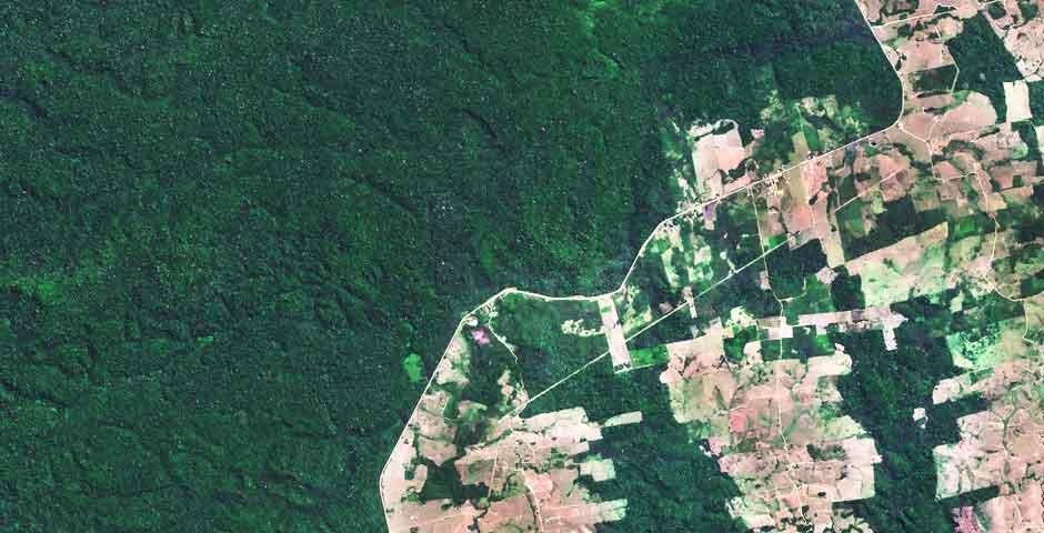
Along with solving real business problems, compliance with environmental regulations through satellite imagery is gaining popularity. It’s connected to the fact that compared to traditional monitoring methods, remote sensing technologies offer many more advantages, including broader coverage and higher accuracy, helping to save money. Conservation and environmental monitoring organizations can observe large areas of our planet’s surface without deploying personnel and equipment. It also reduces the risk to personnel. The application of historical and near real-time satellite images free can also help to track the effectiveness of different environmental protection measures.
Thanks to satellite images and data analysis, it’s now possible to track every stage of oil production and transportation, even in remote areas. This technology can be used during the well development phase to identify any risks and take necessary precautions.
Infrastructure Planning
Implementing large infrastructure projects has many risks due to many interconnected components. However, their performance is necessary because critical infrastructure is vital to urban and rural development.
Engineers and project managers can identify potential problems in a project and take action before significant damage, costs, or delays occur. Using very high-resolution imagery and obtained data provides accurate and easily accessible information without traveling to the site.
Data pre-processing enables engineers to get information about changes instantly. It helps to conduct desk research faster and cost-effectively and take action before damage occurs.
Risk Management
Oil companies are increasingly thinking about improving reliability and introducing technologies at oil production facilities and during the transportation and storage of production products. Wells are usually located in remote places on our planet, which increases the need for monitoring to understand the events and the state of these objects.
Operators also need to monitor the pipeline’s integrity throughout its entire length. The risks associated with accidents and content theft must be reduced or eliminated. It is vital because it is related to financial losses and environmental safety.
Conclusion
Satellite technologies give humanity many opportunities for entertainment and for solving global problems: from satellite television to tracking climate change. Satellite imagery has many applications, including environmental monitoring and tracking natural disasters. They can also be used to identify potential sources of resources and assess the impact of climate change on agriculture and other industries. Remote sensing technologies have been successfully applied to monitor the progress of construction projects and minimize safety risks.
The potential of this market is vast. Imagery data enables companies to understand many operations better and make decisions based on reliable information. It helps not only to get new opportunities but also to reduce costs.